.
Read in Chinese
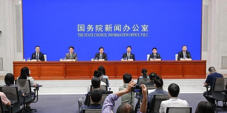
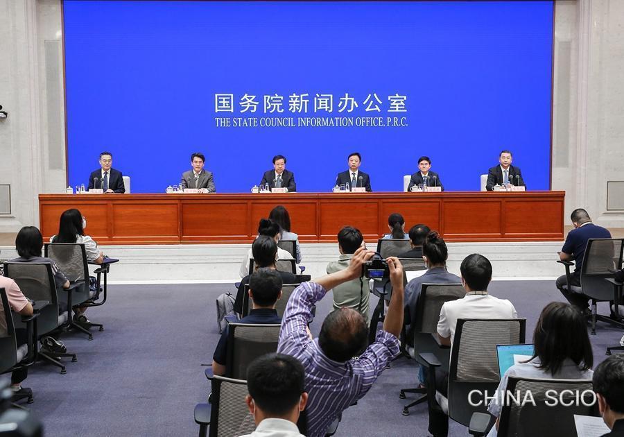
Speakers:
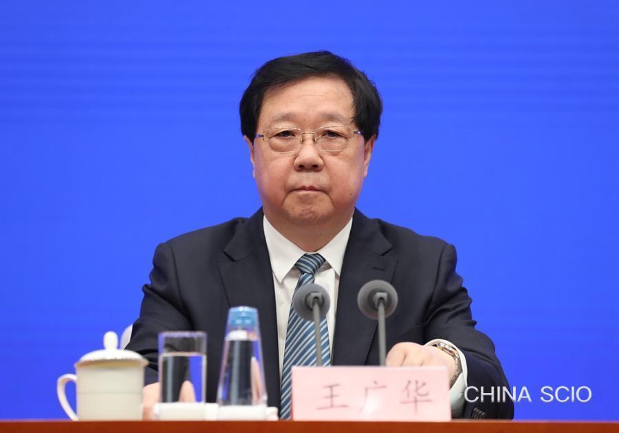
Mr. Wang Guanghua, minister of natural resources and national chief inspector of natural resources
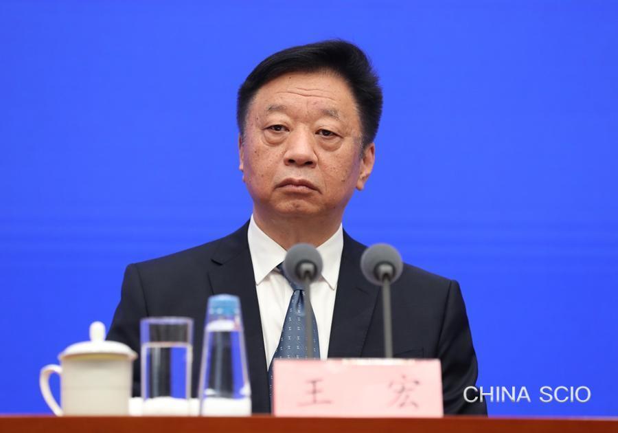
Mr. Wang Hong, vice minister of natural resources and head of the State Oceanic Administration
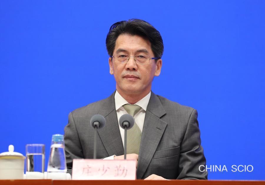
Mr. Zhuang Shaoqin, vice minister of natural resources
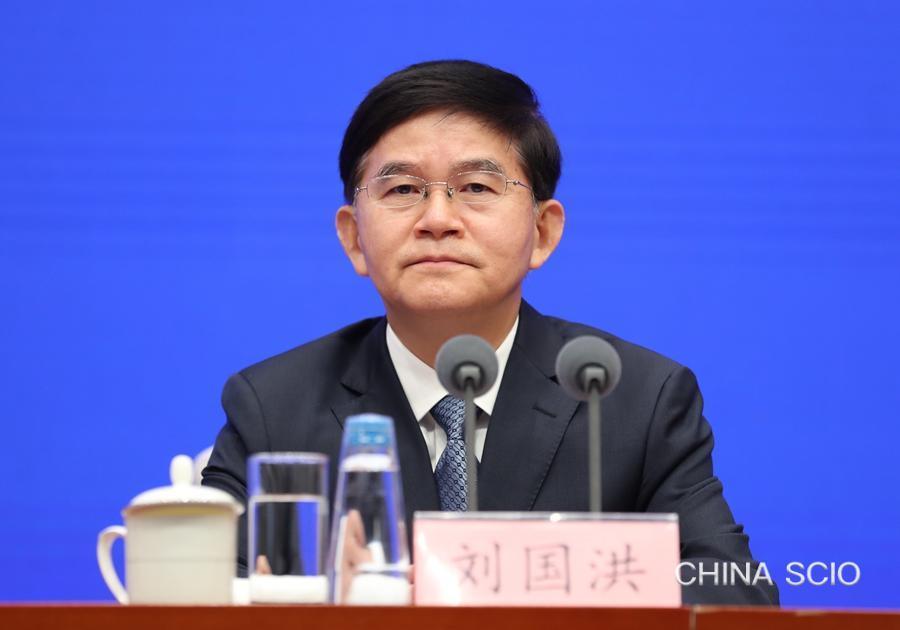
Mr. Liu Guohong, vice minister of natural resources
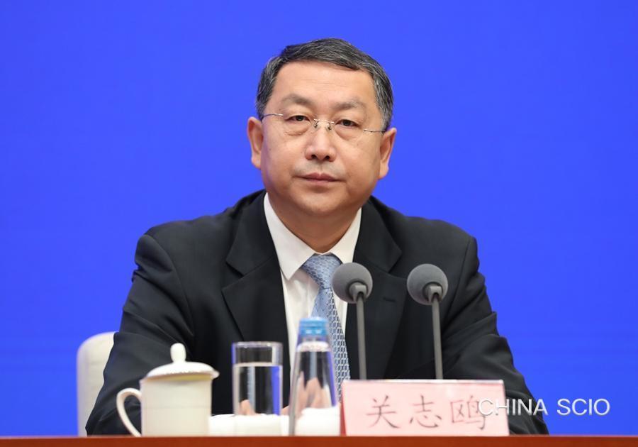
Mr. Guan Zhiou, head of the National Forestry and Grassland Administration (NFGA) and the National Park Administration
Chairperson:
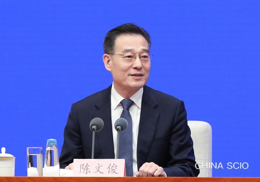
Mr. Chen Wenjun, director general of the Press Bureau of the State Council Information Office (SCIO) and spokesperson of the SCIO
Date:
July 11, 2023
Chen Wenjun:
Ladies and gentlemen, good morning. Welcome to this press conference held by the State Council Information Office (SCIO). This is the 20th briefing in the series "Embarking on the New Journey — A Government Perspective." Today, we have invited Mr. Wang Guanghua, minister of natural resources, to brief you on building the modernization of harmony between humanity and nature, and to take your questions. Also joining us today are Mr. Wang Hong, vice minister of natural resources and head of the State Oceanic Administration ; Mr. Zhuang Shaoqin, vice minister of natural resources; Mr. Liu Guohong, vice minister of natural resources; and Mr. Guan Zhiou, head of the National Forestry and Grassland Administration (NFGA) and the National Park Administration.
Now, I'll give the floor to Mr. Wang for his introduction.
Wang Guanghua:
Thank you, Mr. Chen. Ladies and gentlemen, friends, good morning. I am very glad to meet and talk with you again. First, on behalf of the Ministry of Natural Resources ((MNR)) and the NFGA, I would like to express my gratitude to all of you for your long-term care and support for the work of natural resources as well as the forestry and grassland.
The 20th National Congress of the Communist Party of China (CPC) made strategic deployments on building a modern socialist country in all respects and advancing the great rejuvenation of the Chinese nation on all fronts . It also stipulated that the principle that lucid waters and lush mountains are invaluable assets must be upheld and acted on, and that maintaining harmony between humanity and nature must be remembered when planning developmen t. We have adhered to the guidance of Xi Jinping Thought on Socialism with Chinese Characteristics for a New Era, earnestly implemented Xi Jinping Thought on Eco-Civilization, and fully performed the major tasks deployed by the 20th CPC National Congress. We have always coordinated development with security, oriented ourselves toward strictly observing the bottom line of resource security, optimizing the territorial space layout, promoting green and low-carbon development, and safeguarding the rights and interests of resources and assets, and actively promoted the building of the modernization of harmony between humanity and nature.
First, the bottom line of resource security has been strictly observed. We have earnestly implemented the deployment of ensuring the security of food, energy and resources, as well as industrial and supply chains , and promoted to better safeguard China's new pattern of development with the new security architecture. To ensure food security, we have strictly regulated the offsetting of farmland used for construction, offset farmland used for other agricultural purposes in a stable and orderly manner, frozen the farmland offsetting quota in areas where farmland has been illegally occupied, and worked to maintain the total area of the farmland. We have taken tough measures and constantly conducted inspections and law enforcement for farmland protection, and publicly investigated and dealt with major, typical cases involving illegal violations. In the first half of the year, the number of illegal cases related to land dropped by 64% year on year, with the area involved falling by 80.5% year on year. The total area of farmland nationally has registered net increases for two years in a row. To ensure energy security, we have comprehensively launched a new round of a strategic campaign in mineral exploration, improved the management system for mineral exploration and exploitation, and stimulated the vitality of the mining market. In the first half of the year, national investment in the exploration of solid minerals as well as petroleum and natural gas rose year on year by 17.2% and 7.5%, respectively, and 242 entities nationwide were newly granted exploration rights, a year-on-year increase of 25.4%. Breakthroughs have also been made in mineral exploration at the Laizhou gold mine in Shandong province and the Zhaotong phosphorite mine in Yunnan province. To ensure ecological security, China has comprehensively finished creating ecological conservation red lines for the first time, with the actual area drawn on the landmass and sea areas totaling around 3.19 million square kilometers. We have strengthened the management of the ecological conservation red lines, stringently regulated the approval for occupation, and rigorously observed the natural ecological security boundary. A spatial layout plan for China's national parks has been issued to build the world's largest national park system. Large-scale greening programs have been rolled out in a well-planned manner, and an area of around 100 million mu (6.7 million hectares) will be greened annually for the next few years. The overall plan for the Three-North Shelterbelt Forest Program has been revised and the sixth implementation plan for the program has been formulated, reflecting the consistent efforts being made to promote the construction of a green ecological shelter in northern China. The natural regeneration of forests, grasslands and wetlands has been advanced, and the forest-chief system has been comprehensively established, with nearly 1.2 million forest chiefs appointed at various levels. The list of terrestrial wild animals of important ecological, scientific and social value has been newly updated and publicized, greatly expanding the scope of protection for wild animals. The building of the national botanical gardens system has been actively promoted. To ensure the security of surveying and mapping of geographic information data, we have actively promoted the development of 3D Real Scene China . This year, we released guidelines for the standard system construction for intelligent-vehicle basic maps , to promote the development of self-driving and other new business models under the premise of ensuring the security of geographic information. In addition, we have worked with local regions to enhance the comprehensive prevention and control of geological disasters, marine disasters and risks, forest and grassland fires, and pests , going all out to protect people's lives and property.
Second, we have made efforts to improve the layout of land and space. We have seriously implemented the arrangement to foster a regional economic layout and a territorial space system which leverages complementary strengths of each area and promotes high-quality development. We have advanced the reform of the "integration of various types of plans into a single master plan." A territorial space planning system has taken shape. In the second half of last year, the CPC Central Committee and the State Council released China's first territorial spatial planning outline, which approves red lines for farmland and permanent basic farmland, for ecological conservation, and for delineating urban development boundaries. Overall spatial planning has been accomplished at the provincial, municipal, and county levels, all of which are being reviewed for approval. We have rolled out measures to help local governments make their own detailed plans to provide a legal basis for regulating the use of all territorial space, approving the planning for urban and rural development projects, as well as those activities regarding project development, renovation, protection, and restoration. Moreover, we have reported to the State Council for approval for the overall spatial planning for the demonstration zone for integrated ecological and green development in the Yangtze River Delta. We have also worked hard on the spatial planning for coastal belts and offshore waters, the Beijing-Tianjin-Hebei region and the Chengdu-Chongqing region, to support the implementation of major regional strategies.
Third, we have promoted green and low-carbon development. Taking high-quality development as our priority, we have stepped up efforts to promote economic and social development in a green and low-carbon manner and worked hard to enhance diversity, stability, and sustainability in our ecosystems. We issued a series of policies to improve the use of land and sea areas in the second half of last year and the first half of this year. These policies included streamlining approval procedures and improving approval efficiency to ensure a good momentum of economic development. In the first half of this year, the MNR approved 37,000 mu of land for major projects, an increase of 138.3% year on year. As much as 2.144 million mu of agricultural land have been approved for other uses or requisitioned nationwide, in line with the level of the same period over the past five years. A total of 1.271 million mu of sea areas have been approved for projects, up 24.6% year on year. We have ensured that 4.724 million mu of state-owned land has been used for construction, an increase of 14.2% year on year. We have ramped up efforts to implement a comprehensive conservation strategy, launching land use quotas for new industrial projects and driving the green development of the mining industry. Moreover, we have carried out major projects for protecting and restoring key ecosystems, implementing 51 projects to holistically conserve and restore the mountains, rivers, forests, farmlands, lakes, grasslands and deserts. Among all these projects, seven were launched this year. We have taken solid steps to advance the Blue Bay environmental improvement initiative, the coastal belts protection and restoration project, and a special action for mangrove conservation and restoration to restore coastline and coastal wetlands. The area of mangroves in China has reached 438,000 mu, an increase of around 108,000 mu compared with the beginning of the century. We have ramped up efforts to advance the construction of three major platforms for deep-sea research, including the national gene database for deep-sea creatures. We have also worked hard to improve the national Antarctic and Arctic observing and monitoring network and accelerated the construction of the fifth research station in Antarctica. We have implemented the Green Expedition Initiative in Antarctica. We are currently preparing for the 40th Antarctic scientific expedition and the 13th scientific expedition to the Arctic Ocean. Furthermore, we have made full use of the natural gas hydrate drill ship and been working hard to set up a science and technology center for ocean drilling and planning for relevant international science programs.
Fourth, we have protected the rights and interests of resource assets. Centered on safeguarding the fundamental interests of the overwhelming majority of people, we have accelerated reform in the natural resource assets sector and strengthened the rule of law. We have coordinated the institutional reform of the natural resource property rights system and continuously promoted pilot schemes and agency mechanisms for delegating the ownership of natural resource assets under public ownership. We have deepened the reform of the rural land system and promoted a pilot program allowing rural collective land for construction to enter the land market. We have also established a unified survey, monitoring system, and ownership registration system for natural resources. This includes transferring contractual land rights and land management rights onto a unified registration system for immovable property. We have also launched new measures such as the synchronous delivery of housing or land with its property ownership certificate, and "transfer with mortgage." We've also advanced the formulation and revision of relevant laws and regulations, such as the Mineral Resources Law and the National Parks Law, strengthened the administration of the rule of law, strictly supervised law enforcement, and maintained order in natural resource management.
For the next step, centering on fostering the new development paradigm and promoting high-quality development, the MNR and the NFGA will plug away at our work, forge ahead, and make more outstanding contributions to building a modern socialist country in all respects with concrete efforts.
That's all for my opening remarks. Next, my colleagues and I are ready to answer your questions. Thank you.
_ueditor_page_break_tag_
Chen Wenjun:
Thank you, Mr. Wang. The floor is now open for questions. Please identify the news outlet you represent before raising your questions.
CCTV:
Mineral resources are the important material foundation for socio-economic development. The construction of modern industrial systems is also inseparable from the efficient utilization and development of mineral resources. What arrangements and considerations will the ministry make to further promote exploitation and development, and increase the reserve and production volumes of the country's key energy sources and mineral resources? Thank you.
Wang Guanghua:
This is a question of significant importance and represents an important task that our ministry is currently working on and will continue to focus on. I briefly answered this question during a "minister's passage" interview at this year's Two Sessions. However, we have made new progress after six months of effort. To further implement General Secretary Xi Jinping's important instructions on ensuring national energy and resource security, we have worked with relevant departments to promote the exploitation and development of key energy and mineral resources and boost the reserve and production volumes of those resources. We have meticulously organized and conducted another round of strategic actions in mineral prospecting. These actions are in accordance with the principles of consolidating foundational work, prospering the mining market, and enhancing scientific and technological support. I will elaborate on these three aspects.
Above all, we have strengthened our major foundational work.
First, we conducted national mineral resource surveys, researching all 163 kinds of mineral resources with confirmed reserves in more than 45,000 mining areas across the country. Therefore, we have obtained a comprehensive picture of the quantity, quality, structure, spatial distribution, development, and utilization of various mineral resources in China. Second, we have strengthened the basic geological survey of mineral resources by designating basic research areas and key research areas. This will intensify our efforts in mineral resources research. We have also designated key prospecting and deep mining areas. In these regions, we conduct ore prediction and locate ore bodies, aiming to extend the reach of our mine prospecting work and eliminate all "blind spots" throughout the process. Since the 14th Five-Year Plan period, we have initially designated 124 areas of high prospecting potential and submitted 102 target areas for prospecting. We have also provided guidelines for commercial exploration work with social funds.
Second, the MNR has enhanced policy support for mineral prospecting and exploration.
To begin with, the MNR has improved the system for managing the collection of proceeds from mining rights transfers. In contrast to the previous methods of collecting proceeds in a one-time payment, the new system mandates annual collection based on sales revenue generated from mineral production. This can safeguard the rights and interests of state mineral resource owners and effectively alleviate the burden on enterprises.
The MNR has also improved the registration and management process for the prospecting and exploration of mineral resources. The MNR encourages the adoption of comprehensive mineral prospecting methods. It has revitalized the secondary market for prospecting rights, removing restrictions on the transfer period of prospecting rights obtained through bidding, auction and listing. The MNR now allows the transfer of prospecting rights. It also simplified the application requirements and approval procedures for mining rights registration and improved the efficiency of the approval process.
The MNR has continued reforms in the management of mineral resources. It allows the transfer of resource mining rights of coal seam fissure resources and deep mineral resources to the same subject by agreement. The MNR has adjusted the proportion of mining area deductions during the renewal registration process for prospecting rights. It also introduced a detailed arrangement of the unified system of oil and natural gas prospecting and exploration, extended the retention period of prospecting rights, and improved the mechanism for the competitive transfer of mining rights. These measures have facilitated the prospecting and exploration of mineral resources.
Third, the MNR has strengthened its sci-tech support.
A group of new technologies and methods have been innovatively developed and applied for demonstration purposes. The MNR promoted the implementation of major sci-tech projects and key national plans for research and development (R&D). It also set up a dedicated category for geophysical prospecting within the natural resource science and technology awards, intending to boost the enthusiasm of geological exploration teams.
Going forward, we will collaborate with related government departments to continuously improve related policies. We will also create an enabling environment for all kinds of private actors to invest in the exploration and development of mineral resources. For instance, the MNR has issued directions to local governments on the transfer of "net mining rights ." By improving the preliminary preparatory work for the transfer of mining rights, the MNR helps local governments enhance service efficiency and better ensure the utilization of land, forest, grassland and other factors of production. The MNR also has expedited major mining programs' approval procedures to boost domestic demand, stabilize growth, and facilitate a new round of prospecting campaigns with effective measures.
_ueditor_page_break_tag_
21st Century Business Herald:
According to the report to the 20th CPC National Congress, major projects for preserving and restoring key ecosystems will be carried out at a faster pace in priority areas, including key national ecosystem service zones, ecological conservation redlines, and nature reserves. What progress has been made in ecological conservation and restoration? What measures and major projects will be undertaken next?
Wang Hong:
As we know, the principal challenge facing Chinese society has turned into the gap between unbalanced and inadequate development and the growing expectation of the people for a better life. Creating a fine eco-environment with lucid waters and lush mountains is one of the goals that we strive for. Since the 18th CPC National Congress, We have earnestly implemented Xi Jinping Thought on Eco-Civilization , strengthened planning and guidance, and enhanced coordination. We have also expedited efforts to implement major projects for preserving and restoring key ecosystems and strived to enhance the diversity, stability and continuity of these ecosystems. Progress is evident in the following two aspects.
First, we have established a strategic pattern for ecological protection and restoration of the national territorial space. The National Territorial Spatial Planning Outline (2021-2035) and Master Plan on Major Projects for the Conservation and Restoration of National Key Ecosystems (2021-2035) specified a national ecological security barrier pattern consisting of Three Eco-zones and Four Shelterbelts — the Qinghai-Tibet Plateau Eco-zone, Yellow River Eco-zone and Yangtze River Eco-zone, and Northeast Shelterbelt, North Shelterbelt, South Shelterbelt and Coastal Shelterbelt. Major projects and key tasks such as ecological protection and restoration, natural protected areas, and biodiversity conservation were also arranged accordingly.
Second, we have coordinated and implemented major ecological protection and restoration projects. We have implemented 51 integrated conservation and restoration projects of mountains, rivers, forests, farmland, lakes, grasslands and deserts around Three Eco-zones and Four Shelterbelts. We have also coordinated various ecological elements, taking river basins as the main unit to implement system governance, comprehensive management and source control, completing a total area of 80 million mu of ecological restoration. In 2022, the "Shan-Shui Initiative in China " was awarded as one of the inaugural 10 World Restoration Flagships, and praised as one of the most promising, ambitious and inspiring large-scale examples of ecological restoration in the world. For example, the Wuliangsu Lake Basin Project in Inner Mongolia has adopted regional management and implemented 35 sub-projects in seven categories, according to different natural geographical units and dominant ecosystem types in the basin. A variety of measures have been taken, including desert control, grassland ecological restoration, open pit mining management, artificial wetland restoration and soil erosion control, so as to improve the overall water quality of Wuliangsu Lake. The species and number of resident birds in the area have increased significantly. In addition, in recent years, we have focused on the main body and tributaries of the Yangtze River; the areas surrounding Beijing, Tianjin and Hebei province; the Fenwei Plain; and the Yellow River Basin, so as to promote the ecological restoration of historical mining sites in an orderly manner. Additionally, the total area completing the governance for ecological restoration has reached 4.35 million mu. We have also adhered to land-sea coordination and river-sea linkages, and have carried out major projects such as special campaigns to protect and restore marine ecosystems and the coastal zone conservation and restoration project. As a result, a total of 2,000 kilometers of coastline and 600,000 mu of coastal wetlands have been restored.
Next, we will continue to implement the integrated conservation and restoration projects for mountains, rivers, forests, farmland, lakes, grasslands and deserts. It is expected that by the end of the 14th Five-Year Plan, the ecological conservation and restoration area will total over 30 million mu. We will also implement ecological restoration projects in mining sites, completing the restoration of 2.8 million mu. Additionally, we will implement marine ecological conservation and restoration projects, so as to complete the improvement and restoration of 400 kilometers of coastline, and 300,000 mu of coastal wetlands. Thank you.
_ueditor_page_break_tag_
China Natural Resources News:
As we all know, the territorial spatial planning is a new plan that combines main functional area planning, land-use planning and urban-rural planning. How can we leverage the new advantages of this multiple-plan coordination in territorial spatial planning to create new driving forces and new advantages for high-quality urban and rural development? Thank you.
Zhuang Shaoqin:
Mr. Wang has just briefly introduced the achievements of the multiple-plan coordination. Multiple-plan coordination is not just about resolving the contradictions and conflicts between the different original plans, and integrating the advantages of existing plans. It should also be based on the new development stage, implement new development philosophy, better support the construction of a new development pattern and promote high-quality development in urban and rural areas.
First, the advantage of putting ecology first and pursuing green development. The national territorial space planning that integrates multiple plans into a single masterplan is a new plan for the new era of ecological conservation. We must make development plans from the perspective of harmony between humanity and nature, creating new impetus and advantages. In recent years, we have designated "three types of territorial spaces and three types of control lines" in territorial space planning, namely urban space, agricultural space and ecological space, with three red lines for urban development boundaries, permanent basic farmland and ecological conservation. The aim is to coordinate development and security, optimize the development and protection of territorial space, guide urban and rural areas to build spatial patterns that save resources and protect the environment, and accelerate the building of a new path of high-quality development oriented toward prioritizing eco-environmental conservation and green development, thereby further enhancing the resilience of territorial space and enhancing regional carrying capacity and sustainability.
Second, the advantage of regional coordination and open development. We have implemented the functional zoning strategy, major regional strategies, coordinated regional development strategy, new urbanization strategy, rural revitalization strategy and other national strategies in a well-coordinated manner on the "one map" of territorial space planning. We have optimized the allocation of urban and rural resources and elements to form a regional integrated development pattern featuring coordinated development of large, medium and small cities and small towns, urban-rural integrated development, and two-way opening-up, as well as a multi-center, networked, open and intensive urban pattern. In this way, we can effectively support the construction of a new development pattern and promote common prosperity, enhancing overall regional coordination and competitiveness.
Third, the advantage of taking a people-centered approach and creating a high quality of life. The unified planning system has the advantages of systematic governance and source governance. In response to the people's desire for a high quality of life and particularly the needs of comprehensive development in the post-pandemic era, we must coordinate the working, living, ecological and security needs of urban and rural areas in the overall and detailed planning of territorial space. We must optimize the urban service functions and spatial structure with communities as the basic unit, and build convenient living circles for living, working, traveling, learning and elderly care. Through this "cell therapy" for cities, we can promote the treatment of "urban diseases" and effectively enhance the people's sense of fulfillment, happiness and security.
Fourth, the advantage of building a beautiful China based on the country's resources. The unified territorial space plan requires local governments to protect regional characteristics just as they protect biodiversity, to explore regional natural, historical, cultural and scenic resources, to retain unique urban "genes" such as geographical environment, cultural characteristics and architectural styles. In this way, unique local advantages will be shaped; the traditional standard industrialization approach which risks making cities and towns all look the same will be changed; and local influence, creativity and cohesion will thereby be enhanced.
Fifth, the advantage of integrating technology and policies to ensure the effective implementation of the territorial space plan. Based on the 3D Real Scene China project, we have initially established a digital and smart oversight, evaluation and early warning system for its implementation on the basic information platform for territorial space, as well as a supervision and assessment mechanism for regular examination and evaluation. These moves will ensure that high-quality urban development will come true based on the high-standard urban planning blueprint. Thank you.
_ueditor_page_break_tag_
People's Daily:
We all know that the protection of farmland is of vital importance to a nation, and not crossing the red line of 1.8 billion mu of farmland is a long-term task that requires concerted efforts. What progress has been made in holding both CPC committees and governments accountable for the protection of farmland? And what are the plans going forward in this regard? Thank you.
Liu Guohong:
Thank you to the reporter from People's Daily for the question. As we all know, farmland is the lifeline of grain production and the foundation of the sustainable development of the Chinese nation. General Secretary Xi Jinping has emphasized that farmland is the country's most precious resource and its protection is of utmost importance. Therefore, it is necessary to ensure that the total area of China's farmland stays above the redline of 120 million mu. The key to safeguarding the redline of farmland lies in ensuring that both the CPC committees and governments are held accountable, and ensuring that Party committees and governments at all levels fulfill their primary responsibility in this respect.
Since last year, in accordance with the policy decisions and plans of the CPC Central Committee and the State Council, we have cooperated with the National Development and Reform Commission and other departments to actively promote the integration of assessments on farmland protection and food security. Early this year, the central government issued measures for assessing how well farmland is protected and food security is ensured, providing comprehensive regulations on the assessment targets, content, procedures and application of the assessment results. The overall institutional framework for assessment work has been established. In general, our work is as follows: First, we have ensured that both CPC committees and governments are held accountable, making everyone involved clear about the implementation of the system of responsibility for CPC committees and governments of provinces, autonomous regions and municipalities to protect farmland and ensure food security. Assessment is conducted annually. Second, we have highlighted the key points of assessment and allowed "veto power" over major issues such as surpassing the redline of farmland, reflecting our resolutions of strict control and complete protection. Third, we have standardized the assessment procedures and taken measures such as self-inspection at provincial level and ad hoc on-site inspections, to ensure the objectivity and fairness of assessment results. Fourth, we have strengthened the application of assessment results, specifying that assessment results serve as significant references for comprehensive evaluation, performance assessment and auditing-based accountability of officials. Financial rewards and penalties will be given based on how well protection targets are fulfilled.
We are currently working with relevant departments and heads of CPC committees and governments at the provincial level to sign responsibility agreements for protecting farmland, making a promise to the CPC Central Committee and the State Council in terms of protecting farmland. Next, we will actively work with relevant departments to introduce supporting systems and regulations such as the assessment rules and detailed scoring criteria. Efforts will be made to promote the implementation of assessment measures as soon as possible and put in place requirements to ensure that both CPC committees and governments are held accountable and to implement lifelong accountability, in order to ensure that the total area of China's farmland stays above the redline of 120 million mu and the Chinese people firmly hold their rice bowls in their own hands.
Thank you.
_ueditor_page_break_tag_
China Daily:
In recent years, China has intensified efforts to prevent and control desertification, making sand prevention and control a major task. A number of significant ecological projects, such as the Three-North Shelterbelt Forest Program, have been implemented. Could you please introduce the progress China has made in terms of sand prevention and control? And what are the plans for future work? Thank you.
Guan Zhiou:
Thank you. This year marks the 45th anniversary of the implementation of the Three-North Shelterbelt Forest Program. Through the unremitting efforts of several generations, and especially since the 18th CPC National Congress, the construction of the Three-North Shelterbelt Forest Program has achieved remarkable accomplishments. Under the program, China has planted 480 million mu of trees, and improved 500 million mu of sandified lands and 1.28 billion mu of degraded grasslands. Particularly in key areas, we have witnessed a historic transition from "sand forcing humans to retreat" to "trees forcing sand to retreat." Practice has proven that the decisions made by the CPC Central Committee on sand prevention and control, especially on implementing the Three-North Shelterbelt Forest Program, are correct and farsighted. China has embarked on a path of sand prevention and control with Chinese characteristics that is in line with the natural laws and its national conditions.
On June 6 this year, General Secretary Xi Jinping made an important speech at a symposium on strengthening the comprehensive prevention and control of desertification and promoting the construction of key ecological projects, including the Three-North Shelterbelt Forest Program (TSFP). The symposium was held in the city of Bayannur, north China's Inner Mongolia autonomous region. He stressed that the TSFP is of great concern to our country's ecological security, the building of a great country, and the sustainable development of the Chinese nation. It is a major national strategy and a great accomplishment at the present time that will benefit future generations. He called on those involved to shoulder the mission with courage, determination and perseverance to create new miracles in China's fight against desertification in the new era. As the responsible department, we will keep in mind his entrustment, resolutely shoulder political responsibility for desertification prevention and control, and promote the construction of the TSFP. In this endeavor, we must build upon the progress made thus far. We must focus on crucial areas, uniting our efforts, and wholeheartedly engaging in the following three pivotal battles.
The first battle entails tackling the formidable challenge of combating desertification in the areas near the meandering bends of the Yellow River. This project encompasses regions across five provinces: Shanxi, Inner Mongolia, Shaanxi, Gansu and Ningxia. It serves as a crucial ecological security barrier in the northern part of the country. We will focus on managing Maowusu, Kubuqi, Ulan Buh, and other desert areas. We will comprehensively implement systematic regional management practices for mountains, waters, forests, farmlands, lakes, grasslands, and harnessing deserts. Additionally, we will actively promote ecological photovoltaic desertification control measures to significantly reduce ecological hazards caused by factors such as sand and salinity. These efforts aim to provide ecological support for the high-quality development of economic circle near the meandering bends of the Yellow River.
The second battle is to combate desertification in the sand lands of Horqin and Hunshandake. The project area is spread across five provinces: Hebei, Inner Mongolia, Liaoning, Jilin and Heilongjiang. It is the nearest source of sand to Beijing. We need to scientifically plan major ecological protection and restoration projects to achieve complete coverage of controllable desertified land in the region. This will involve steadily increasing the coverage of forests and grassland vegetation, thereby cutting off the source of sandstorms that affect the Beijing-Tianjin-Hebei region. We aim to build a reliable ecological barrier that safeguards black soil and ensures food security.
The third battle is focused on battling desertification in the Hexi Corridor-Taklimakan Desert region. This project area spans four provinces: Inner Mongolia, Gansu, Qinghai, and Xinjiang, and is a region of continuous natural deserts in northwest China, connected to the Gobi. It is crucial to enhance the management of key sandy areas and cross-border sources of sandstorms, particularly by constructing wind-proof sand-fixing forests and grass belts along the periphery of oases and desert edges. This measure will prevent the expansion and spread of sand sources.
To undertake these three pivotal battles, we are collaborating with relevant provinces, regions, and departments to initiate and implement several vital projects for preventing and controlling desertification as soon as possible. We aim to establish a strong foundation, ensuring a good start for carrying out the TSFP in the new era. Thank you.
_ueditor_page_break_tag_
Beijing Youth Daily:
The report to the 20th CPC National Congress proposed developing a national park-based nature reserve system. We have observed that the first batch of national parks has been established in our country. What progress has been made in national park development? What are the upcoming key tasks? Thank you.
Guan Zhiou:
Thank you for your question, attention, and support towards developing national parks. Establishing national parks is a crucial task, a major institutional innovation in ecological civilization, and another example guided by Xi Jinping Thought on Eco-Civilization. Through collaborative efforts, we have achieved two noteworthy milestones in this regard.
First, China launched a plan for the layout of its national parks, which includes 49 candidate areas for national parks, accounting for 10.3% of the country's land area, containing more than 5,000 species of terrestrial vertebrates and 29,000 species of higher plants, protecting more than 80% of key state-protected wildlife species and their habitats. Through the construction of national parks, we will protect our most important natural ecosystems, our most unique natural landscapes, our best natural heritage and our most biodiverse areas, which will save precious natural assets for future generations. The construction of national parks fully reflects the joint building and sharing of the community, which will benefit more than 400 counties in 28 provinces, and form a grand pattern in which 56 ethnic groups paint a beautiful picture of national parks and share the ecological well-being of national parks.
Second, construction of the first batch of national parks has achieved remarkable results. The Sanjiangyuan National Park has realized the overall protection of the sources of the Yangtze, Yellow and Lancang rivers. The current forest and grass coverage rate has reached more than 74%, and the Tibetan antelope population has recovered to more than 70,000. The Giant Panda National Park has implemented innovative systems and integrated resources to establish the China Conservation and Research Center for the Giant Panda. It has successfully protected more than 70% of giant pandas in the wild, and has opened 13 ecological corridors for giant panda populations. The Northeast China Tiger and Leopard National Park has established a protection mechanism integrating protection, monitoring and scientific research. Tiger and leopard populations continue to increase. To date, the population of wild Siberian tigers has exceeded 50, and the population of wild Amur leopards has exceeded 60. The Hainan Tropical Rainforest National Park focuses on strengthening the protection and restoration of rainforest habitats and has established the Conservation and Research Center for the Black Crested Gibbon. The population of black crested gibbons has increased to 37, which is made up of six families. The Wuyi Mountain National Park has achieved coordinated protection and development, in particular by establishing a development pattern that integrates ecological conservation, green development and improvement of people's livelihoods. In recent years, 17 new species have been discovered, including Megophrys ombrophila and Gastrodia fujianensis.
Next, we will focus on three tasks: First, we will promote the introduction of the National Park Law. Second, we will develop the first batch of national parks to a high quality. Third, we will actively promote the establishment of new national parks.
Friends from the media, the second National Park Forum will be held in Xining, Qinghai province, in August to show the fruitful results of national park construction. I would like to sincerely invite all of you to come see our national parks. Let's work together to make new contributions to the protection of biodiversity and the building of a modern world where humans and nature live in harmony. Thank you.
_ueditor_page_break_tag_
Thecover.cn:
The report to the 20th CPC National Congress stressed that China will develop the marine economy, protect the marine ecological environment, and step up efforts to build China into a strong maritime country. What deployments have been made in building China into a strong maritime country? How is the related work progressing? And what are the next steps? Thank you.
Wang Hong:
Thank you for your questions. General Secretary Xi Jinping attaches great importance to marine work, emphasizing that the ocean is a strategic location for high-quality development. The MNR should thoroughly learn and implement the guiding principles of the 20th CPC National Congress on strategic plans for accelerating China's development into a strong maritime country. We are actively planning how to open new ground and accelerate the implementation of new deployments. The progress of relevant work mainly includes the following four aspects:
First, we have promoted the marine economy's high-quality development. In 2022, China's total marine economy GDP reached 9.4628 trillion yuan, accounting for 7.8% of national GDP. In particular, emerging marine industries maintained rapid growth momentum. New orders and hand-held orders in the marine engineering equipment manufacturing industry increased by 175.9% and 34.6% in value, respectively, compared to the previous year. Meanwhile, offshore wind power generation increased by 116.2% year on year. China's first megawatt-scale tidal energy unit achieved grid-connected power generation, and the scale of seawater desalination projects further expanded.
Second, we have strengthened the protection and utilization of marine resources. Since the 20th CPC National Congress, the MNR has strictly controlled land reclamation from the sea. It has strengthened the protection of uninhabited islands and maintained the bottom line of natural coastline retention rate. We have continuously optimized the pattern of marine space protection and development. From January to May 2023, 10 suspected illegal land reclamation cases involving approximately 2.19 hectares were exposed and stopped nationwide, and four suspected illegal uses of islands covering about 0.81 hectares were identified. While strictly adhering to the bottom line of marine ecological security, we strive to ensure the use of sea areas and islands for major national projects and people's livelihood projects. This year, the MNR has submitted 17 project sea use applications to the State Council, involving an investment of approximately 134 billion yuan.
Third, we have enhanced marine monitoring and early warning capabilities. The MNR has continuously promoted the construction of the National Global Ocean Observation Network. This network forms an integrated observation system that combines marine station networks, radar networks, buoy networks, seabed observation networks, volunteer ships, cross-sectional surveys, and satellite remote sensing. We have also implemented the "chip" project for marine forecasting and made significant progress in independent innovation. We have named our own marine model "Mazu," and the "Mazu" series of marine early warning models have achieved operational status. China possesses complete independent intellectual property rights over the models.
Fourth, we have deeply participated in global marine governance. Our ministry has been actively developing blue partnerships, promoting the implementation of the United Nations' 2030 Agenda for Sustainable Development, and actively participating in negotiations on marine rules within the UN framework such as an international agreement on the conservation and sustainable use of marine biological diversity of areas beyond national jurisdiction and the regulations on the development of mineral resources in the international seabed area. We are also playing a leading role in China's participation in the "United Nations Decade of Ocean Science for Sustainable Development" initiative ("Ocean Decade") and have proposed the "Digital Deep-sea Typical Habitats Program," which has been approved by the United Nations as a big science program under the "Ocean Decade," to promote the conservation and sustainable use of deep-sea biodiversity. All these moves are part of our vigorous efforts to promote the building of a marine community with a shared future. In April of this year, the 39th Chinese Antarctic expedition successfully completed all planned tasks and returned to China on board the icebreakers "Xuelong 2" and "Xuelong." Tomorrow, on July 12, the 13th Chinese Arctic expedition will depart from Shanghai on board the icebreaker "Xuelong 2" to conduct field research tasks.
In the next step, the MNR will, in accordance with the arrangements of the 20th CPC National Congress, fully and accurately implement the new development concept. We will adhere to the coordinated development of land and sea, vigorously enhance the economical and intensive use of marine resources, focus on building a modern marine industry system, promote the high-quality development of the marine economy, and make new contributions to building China into a strong maritime country.
Thank you!
_ueditor_page_break_tag_
Nanfang Metropolis Daily:
Surveying and mapping geographic information is an important data factor that natural resource departments have been diligently improving. What plans have been made regarding this work? What role will surveying and mapping geographic information play in protecting and utilizing natural resources to support high-quality economic and societal development, and contribute to the construction of Beautiful China? Thank you.
Liu Guohong:
Thank you for your question. With the accelerating pace of global digitization, we're swiftly advancing the Digital China Initiative. General Secretary Xi Jinping has stressed that spatio-temporal information and positioning and navigation services have evolved into vital new types of infrastructure. The CPC Central Committee and the State Council have laid out specific plans to promote the construction of a real 3D China and expedite the widespread application of the Beidou Navigation Satellite System.
The MNR is focusing on four aspects to advance the implementation of these arrangements. First, we are establishing a unified spatio-temporal database to construct a Digital China. This involves building a network of national satellite navigation and positioning base stations based on the Beidou Navigation Satellite System, accelerating the creation of a real 3D China and a spatio-temporal big data platform, and achieving connectivity between the digital and actual worlds. Second, we are generating rich data to support high-quality development. This data supports natural resources management, empowers government management and decision-making, contributes to the development of the digital economy, and meets the public's desire for a better life. Third, we are creating a sound environment conducive to the growth of the geographic information industry. This includes establishing and improving the basic institutions for surveying and mapping geographic information data, strengthening data supply, and supporting regulated data flow to promote the healthy development of new business forms. Last, we are maintaining the fundamental line of data security in surveying and mapping geographic information to build a new security architecture. We are creating new data security technologies and enhancing regulations and services for the sector.
Concerning the optimal utilization of surveying and mapping geographic information to facilitate economic and social development, our work will focus on two aspects.
First, we plan to leverage geographic information to conserve and utilize natural resources. Utilizing data from the real 3D China project and supported by real-time remote sensing data from satellites, we will build spatio-temporal connections between geographical bodies, natural resource entities, and immovable property entities. This aims to cover all areas, link all steps in the chain, and regulate the whole process. This includes investigating and monitoring natural resources; determining and registering natural resource rights; planning and regulating territorial space use; conservation and restoration of the ecosystem; and inspections and law enforcement for natural resources. This will provide services and support for the construction of a Beautiful China. For example, as a leading user, the MNR has 25 domestic satellites in orbit at present. We now update the 2-meter resolution images of our territory every quarter and the sub-meter resolution images annually. This allows us to identify changes in land surface space accurately and promptly, thus better supporting the dynamic regulation over the conservation and use of territorial space.
In addition, we will apply geographic information to foster high-quality economic and societal development. We aim to enhance the coordination of these data with other factors of production, ensuring fast, accurate, and intelligent spatio-temporal matching. This approach seeks to make resource allocation more effective, aiding the transition towards greener and more carbon-efficient development. For example, surveying and mapping geographic information serves as a geographical spatial database and a platform for data integration, applicable across various sectors and industries, and beneficial to countless households. This allows us to offer quality services in digital applications, including government management, disaster prevention and relief, the shared economy, smart transportation, and logistics and express delivery. It can be said that everyday activities such as sending and receiving express mail, hailing cabs, and more all rely on support from geographic data.
Next, in line with the demands of high-quality development, we will transform and upgrade our surveying and mapping practices. This holistic approach is designed to lend robust support to the progress of the Digital China Initiative and the Beautiful China Initiative. Thank you.
_ueditor_page_break_tag_
Chen Wenjun:
The last question, please.
CNR:
Just now, Mr. Wang mentioned that China issued its first territorial space plan outline. What new measures will be taken to advance the reform of integrating different plans into a single master plan for territorial space development on the new journey? Thank you.
Zhuang Shaoqin:
Thank you for your attention to the reform of integrating various plans into a single master plan. When the national territorial space plan outline was issued last year, the CPC Central Committee provided clear requirements for deepening the reform of consolidating multiple plans into one master plan. To advance this reform further, our focus should be on implementing the important instructions of General Secretary Xi Jinping and the strategic plans laid out at the 20th CPC National Congress. The main aspects are as follows.
First, we will further develop the territorial space system. Acting upon the requirements set forth in the report to the 20th CPC National Congress for establishing a regional economic layout and a territorial space system that leverage each other's strengths, promote high-quality development, and improve urban planning, construction, and governance, we will hasten the formulation of special plans for trans-administrative regional and cross-watershed territorial spaces such as city clusters, metropolitan areas, and the Yangtze Economic Belt. This is based on the completion of the master plan for territorial space at different levels, providing stronger support for constructing a new pattern of development. Meanwhile, we will accommodate the needs arising from the fact that the development of land spaces in urban and rural areas now entirely depends on existing resources after the delineation of "three spaces and three lines," which refers to three types of land spaces - urban, agricultural, and ecological – as well as the red lines for ecosystem protection, permanent basic farmland designation, and boundaries for urban development. We will guide local governments to enhance the detailed planning system for integrating various types of plans into a single master plan, provide better guidance for urban renewal projects and rural development initiatives, and move faster to blaze a new path toward high-quality green development characterized by efficiency and effectiveness.
Second, we will enhance the functional zoning system. In accordance with the requirement for improving the functional zoning system and the development of territorial space outlined in the report to the 20th CPC National Congress, we will initiate the drafting of the implementation plan for national major functional zones. Furthermore, we will refine the system of supporting policies for functional zones and implement differentiated policies for special functional zones. This includes areas such as key ecological reserves, regions abundant in energy resources, locations rich in historical and cultural resources, and border areas. This will allow us to maximize their comparative advantages and take coordinated steps to promote the full implementation of the functional zoning strategies and other relevant national strategies in territorial space development.
Third, the supervision system for implementing territorial space plans will be improved. In accordance with the principle of full-life-cycle management and the requirement for unified criteria, planning, and the use of a shared digital map and platform, we will establish and refine the mechanism for category-based management and regulation of territorial space. We will also advance the digital and intelligent transformation of planning and regulation of the use of all territorial space. Furthermore, we will develop a list of special territorial space plans and enhance the network for the supervision, evaluation, and early warning of implementing territorial space plans. We will refine the dynamic mechanism for adjusting plans and resolve past issues, such as non-implementation or changes in plans due to adjustments in leadership teams, ensuring that a single blueprint will be thoroughly implemented until the end.
Fourth, we will bolster the development of the supporting system for territorial space planning. We will actively promote legislation for territorial space and enhance the planning standard system for integrating multiple plans into a single master plan. We will fortify the development of the territorial space planning discipline and foster talent for innovation. Furthermore, we'll continue to reform the qualification management of units that draft plans and the system of registered planners. We will strengthen the guidance and management of industrial associations and encourage public participation and supervision of planning, thereby nurturing a more favorable environment for the healthy development of territorial space planning.
Thank you!
Chen Wenjun:
Thanks to all the speakers and friends from the media. Today's briefing is hereby concluded.
Translated and edited by Xu Xiaoxuan, Wang Qian, Gong Yingchun, Huang Shan, Qin Qi, Zhou Jing, Zhu Bochen, Zhang Rui, Yang Xiaoqing, Wang Yiming, Liu Caiyi, Wang Wei, Cui Can, Yuan Fang, Wang Yanfang, Wang Mengru, Xiang Bin, Xu Kailin, Liu Qiang, Li Huiru, David Ball, and Jay Birbeck. In case of any discrepancy between the English and Chinese texts, the Chinese version is deemed to prevail.